
Quidebook for Szklarska Poręba
City/town information
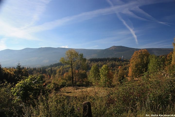
We wish to encourage you to visit one of the most beautiful corners in our country; to visit Szklarska Poręba, a town which can satisfy all “touristic tastes” for adventure, recreation and contact with nature.
Szklarska Poręba – it is a town beautifully located in the valley of the Kamienna River and its tributaries at the height of 440-886m above sea-level, surrounded from the south by the slopes of Karkonosze, with Mt. Szrenica (1362m AMSL) towering over the town, from the north by the Jizera Mountains with the High Stone (1058m AMSL) and the Black Mountain (965m AMSL), and from the East by the Foothills of Karkonosze, separating the town from Jeleniogórska Valley.
The town is divided into Lower,Middle and Upper Szklarska Poręba. The biggest part is Górna, with the following districts: Downtown, Marysin, Szklarka, White Valley and Jakuszyce, the highest colony next to the border crossing with the Czech Republic.
While having relatively few permanent residents (around 7.3 thousand), Szklarska Poręba has a big area of 74 km2, 86% of which is forest. There are few places in Poland that are as favorable for recreation as the area of Szklarska Poręba. Silence, the landscapes changing constantly depending on the light or the time of the day, combined with the humming of crystal-clear springs and waterfalls surrounded by granite rocks – these elements all have an extraordinarily soothing effect on human nature.
21 yerel halk öneriyor
Szklarska Poręba
We wish to encourage you to visit one of the most beautiful corners in our country; to visit Szklarska Poręba, a town which can satisfy all “touristic tastes” for adventure, recreation and contact with nature.
Szklarska Poręba – it is a town beautifully located in the valley of the Kamienna River and its tributaries at the height of 440-886m above sea-level, surrounded from the south by the slopes of Karkonosze, with Mt. Szrenica (1362m AMSL) towering over the town, from the north by the Jizera Mountains with the High Stone (1058m AMSL) and the Black Mountain (965m AMSL), and from the East by the Foothills of Karkonosze, separating the town from Jeleniogórska Valley.
The town is divided into Lower,Middle and Upper Szklarska Poręba. The biggest part is Górna, with the following districts: Downtown, Marysin, Szklarka, White Valley and Jakuszyce, the highest colony next to the border crossing with the Czech Republic.
While having relatively few permanent residents (around 7.3 thousand), Szklarska Poręba has a big area of 74 km2, 86% of which is forest. There are few places in Poland that are as favorable for recreation as the area of Szklarska Poręba. Silence, the landscapes changing constantly depending on the light or the time of the day, combined with the humming of crystal-clear springs and waterfalls surrounded by granite rocks – these elements all have an extraordinarily soothing effect on human nature.
Zwiedzanie
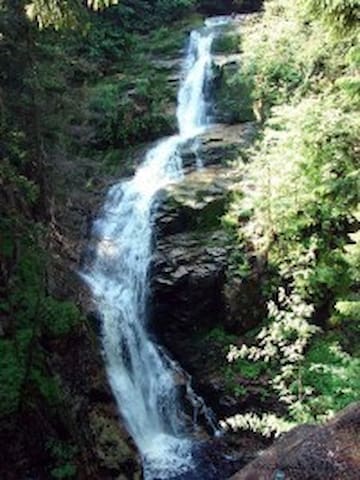
Szklarka Waterfall is the picturesquely situated waterfall in The Karkonoski National Park Enclave covering the gorgeous main part of Szklarka creek called Wąwóz Szklarki [Szklarka Gorge]. In the middle part of the Gorge, on a rocky threshold 520 m above sea level, Szklarka Waterfall cascades down narrowing and turning spirally at the bottom. The waterfall’s stream is 13,3 m high.
The left bank of rocky threshold is covered by large marmites (deepening in creek or river bottom created by evorsion at the waterfall’s foot, or a rocky threshold).
First information about Szklarka Waterfall appeared in the Middle Ages. Through all centuries until present times the waterfall was the object of pictures, photographs, descriptions since it was considered the place of unique beauty and romantic atmosphere. In 1868 an inn was build by the waterfall which, in time, was transformed into the currently functioning “Kochanówka” Hostel. An exceptional attraction for 19th century tourists was regulating the flow of water reaching the waterfall and letting it off after collecting fees from visitors.
Access: from city centre following green trail along Kamienna River, or black trail (a trail surrounding Szkalrska Poręba). Next to Szklarka Waterfall there also runs blue trail from Piechowice to the hostel “Pod Łabskim Szczytem” [“At the Foot of Łabski Peak”].
31 yerel halk öneriyor
Szklarki Şelalesi
Szklarka Waterfall is the picturesquely situated waterfall in The Karkonoski National Park Enclave covering the gorgeous main part of Szklarka creek called Wąwóz Szklarki [Szklarka Gorge]. In the middle part of the Gorge, on a rocky threshold 520 m above sea level, Szklarka Waterfall cascades down narrowing and turning spirally at the bottom. The waterfall’s stream is 13,3 m high.
The left bank of rocky threshold is covered by large marmites (deepening in creek or river bottom created by evorsion at the waterfall’s foot, or a rocky threshold).
First information about Szklarka Waterfall appeared in the Middle Ages. Through all centuries until present times the waterfall was the object of pictures, photographs, descriptions since it was considered the place of unique beauty and romantic atmosphere. In 1868 an inn was build by the waterfall which, in time, was transformed into the currently functioning “Kochanówka” Hostel. An exceptional attraction for 19th century tourists was regulating the flow of water reaching the waterfall and letting it off after collecting fees from visitors.
Access: from city centre following green trail along Kamienna River, or black trail (a trail surrounding Szkalrska Poręba). Next to Szklarka Waterfall there also runs blue trail from Piechowice to the hostel “Pod Łabskim Szczytem” [“At the Foot of Łabski Peak”].
The highest waterfall in the Polish part of The Karkonosze Mountains. Its threshold is situated at the altitude of 843 m above sea level. The waterfall forms a three-level cascade 27 m high falling to the gorgeousKamieńczyk Gorge. The gorge is about 100 m long with vertical, rocky walls reaching over 25 m in height while its width at some parts is less than 4 meters. Behind the middle waterfall cascade there is a cave called“Złota Jama” [“Golden Cave”] hammered by the Walloons and famous for pegmatite and amethyst stones concentration. By the waterfall there is “Kamieńczyk” hostel and “Szałas Sielanka” [“Idyll Shelter”].
Access: from town centre along red trail (GSS) – from the knot of Szklarsa Poręba centre trails at Sikorskiego Street, or along black trail past lower station of “Szrenica” Chair Lift.
23 yerel halk öneriyor
Kamienczyk Şelalesi
The highest waterfall in the Polish part of The Karkonosze Mountains. Its threshold is situated at the altitude of 843 m above sea level. The waterfall forms a three-level cascade 27 m high falling to the gorgeousKamieńczyk Gorge. The gorge is about 100 m long with vertical, rocky walls reaching over 25 m in height while its width at some parts is less than 4 meters. Behind the middle waterfall cascade there is a cave called“Złota Jama” [“Golden Cave”] hammered by the Walloons and famous for pegmatite and amethyst stones concentration. By the waterfall there is “Kamieńczyk” hostel and “Szałas Sielanka” [“Idyll Shelter”].
Access: from town centre along red trail (GSS) – from the knot of Szklarsa Poręba centre trails at Sikorskiego Street, or along black trail past lower station of “Szrenica” Chair Lift.
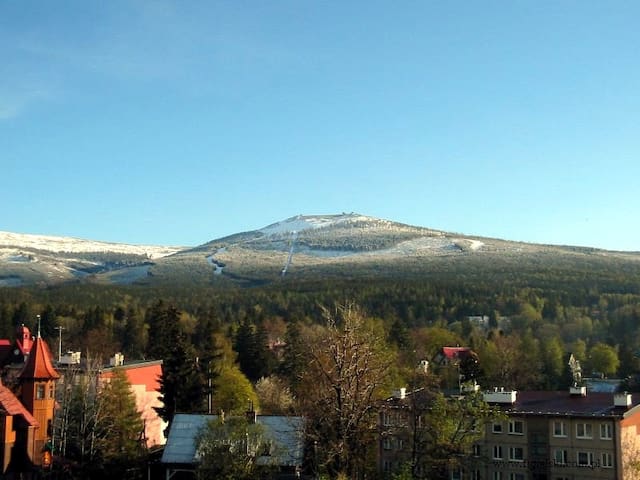
This is the name of the mountain peak overlooking the city, as part of the Central Crest of The Karkonosze Mountains. Its altitude is 1362 m above sea level and can be reached by a chair lift from SKI ARENA at the foot of Szrenica. A well known mountain hostel “Szrenica” welcomes tourists at the top of the mountain covered by a granite disforest. Even though Szrenica is not a high mountain it offers climatic and snow cover conditions very similar to The Alpes at the altitude of 2000 m above sea level, which provides excellent skiing conditions and well functioning skiing infrastructure. 20 km of ski pists along Szrenica slopes, as well as the overall network of ski lifts, have been attracting enthusiasts of white craze to Szklarska Poręba for years. Szrenica also offers an excellent view point over Jelenia Góra Valley, The Izery Mountains and The Kaczawskie Maountains. Next to the top there are three interesting rock groups – Końskie Łby [Horse Heads], Szronowiec[Hoar-frosted rock], Trzy Świnki [Three Pigs].
Access: along red trail (Główny Szlak Sudecki [Main Sudeten Trail],or for less persistent tourists by a chair lift and about 10 min. walk along black trail. Northern and eastern slopes of Szrenica are traversed by a green trail from Hala Szernicka past Końskie Łby to the mountain hostel at the foot of Łabski Szczyt.
17 yerel halk öneriyor
Szrenica
This is the name of the mountain peak overlooking the city, as part of the Central Crest of The Karkonosze Mountains. Its altitude is 1362 m above sea level and can be reached by a chair lift from SKI ARENA at the foot of Szrenica. A well known mountain hostel “Szrenica” welcomes tourists at the top of the mountain covered by a granite disforest. Even though Szrenica is not a high mountain it offers climatic and snow cover conditions very similar to The Alpes at the altitude of 2000 m above sea level, which provides excellent skiing conditions and well functioning skiing infrastructure. 20 km of ski pists along Szrenica slopes, as well as the overall network of ski lifts, have been attracting enthusiasts of white craze to Szklarska Poręba for years. Szrenica also offers an excellent view point over Jelenia Góra Valley, The Izery Mountains and The Kaczawskie Maountains. Next to the top there are three interesting rock groups – Końskie Łby [Horse Heads], Szronowiec[Hoar-frosted rock], Trzy Świnki [Three Pigs].
Access: along red trail (Główny Szlak Sudecki [Main Sudeten Trail],or for less persistent tourists by a chair lift and about 10 min. walk along black trail. Northern and eastern slopes of Szrenica are traversed by a green trail from Hala Szernicka past Końskie Łby to the mountain hostel at the foot of Łabski Szczyt.
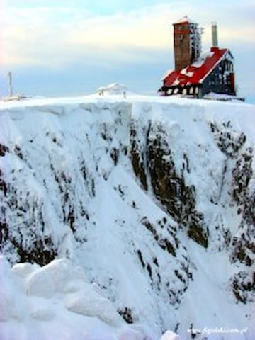
These are two best formed postglacial kettles in The Karkonosze Mountains with well preserved glacial forms. They are divided by a narrow rocky perch and squeezed into northern slopes of The Karkonosze central crest, between Łabski Szczyt and Wielki Szyszak. Vertical rocky walls are about 200 m high and the altitude of Duży Kocioł [Large Kettle] top edge reaches 1490 m above sea level. Inside and at the bottom of Duży Kocioł [Large Kettle] there are two small Śnieżne Satwki [Snowy Ponds].
Duży Kocioł (east side) is 800 m long, 600 m wide and together with Mały Kocioł[Small Kettle] (west side) constitutes a strict nature reserve covering the area of 127 hectares. Kettles’ names originate from patches of snow which persist below their vertical stony edges till late Summer (in 1970 till 2nd September). Śnieżne Kotły also represent the area of very rich mountain flora, not only in The Karkonosze Mountains, but also in the whole Sudeten mountain range. Over Śnieżne Kotły there are rocks called Czarcia Ambona [The Devil’s Pulpit] – a view point overlooking kettles’ bottom, next to it there is RTV transmission station building.
Access: Główny Szlak Sudecki [Main Sudeten Trail] (red – along the crest), or from Hala Pod Łabskim Szczytem [Mountain Pasture at the bottom of Łabski Peak] along yellow trail. It is possible to reach the inside of Snowy Kettles following green trail from Hala Pod Łabskim Szczytem along the, so called, “Ścieżka nad reglami” [The path along subalpine forests] (Attention! Difficult trail, closed in winter!).
14 yerel halk öneriyor
Saklikent Kanyonu
23 SudeckaThese are two best formed postglacial kettles in The Karkonosze Mountains with well preserved glacial forms. They are divided by a narrow rocky perch and squeezed into northern slopes of The Karkonosze central crest, between Łabski Szczyt and Wielki Szyszak. Vertical rocky walls are about 200 m high and the altitude of Duży Kocioł [Large Kettle] top edge reaches 1490 m above sea level. Inside and at the bottom of Duży Kocioł [Large Kettle] there are two small Śnieżne Satwki [Snowy Ponds].
Duży Kocioł (east side) is 800 m long, 600 m wide and together with Mały Kocioł[Small Kettle] (west side) constitutes a strict nature reserve covering the area of 127 hectares. Kettles’ names originate from patches of snow which persist below their vertical stony edges till late Summer (in 1970 till 2nd September). Śnieżne Kotły also represent the area of very rich mountain flora, not only in The Karkonosze Mountains, but also in the whole Sudeten mountain range. Over Śnieżne Kotły there are rocks called Czarcia Ambona [The Devil’s Pulpit] – a view point overlooking kettles’ bottom, next to it there is RTV transmission station building.
Access: Główny Szlak Sudecki [Main Sudeten Trail] (red – along the crest), or from Hala Pod Łabskim Szczytem [Mountain Pasture at the bottom of Łabski Peak] along yellow trail. It is possible to reach the inside of Snowy Kettles following green trail from Hala Pod Łabskim Szczytem along the, so called, “Ścieżka nad reglami” [The path along subalpine forests] (Attention! Difficult trail, closed in winter!).
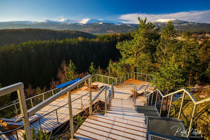
It is a huge and very steep rocky threshold extending over Kamienna River valley at the altitude of 20 m and represents an excellent view point over The Karkonosze Mountains, Szrenica and Śnieżka peaks.
Near it there are The Grave of Karkonosz andChybotek Rock – beauty spots which became the subject matter of numerous legends.
Access from blue trail, near Matejki street.
9 yerel halk öneriyor
Altın Manzara
It is a huge and very steep rocky threshold extending over Kamienna River valley at the altitude of 20 m and represents an excellent view point over The Karkonosze Mountains, Szrenica and Śnieżka peaks.
Near it there are The Grave of Karkonosz andChybotek Rock – beauty spots which became the subject matter of numerous legends.
Access from blue trail, near Matejki street.
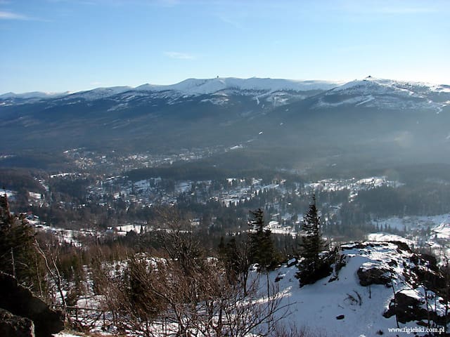
Wysoki Kamiń is the peak 1058 m above sea level overlooking Szklarska Poręba from the west and situated in the High Crest of The Izery Mountains. There are characteristic picturesque rocks at the top from which one of the most beautiful panoramas of The Sudety Mountains can be admired. The following ranges are visible from this point: The Karkonosze Mountains, The Rudawy Janowickie Mountains, The Izery Mountains, The Izerskie Plateau, The Kaczawskie Mountains, The Kaczwskie Palteau and Jelenia Góra Valley.
Until 1963 a tourist hostel was functioning there. At present a small shop and a buffet are open and a new hostel is under construction. The Gołba family from Szklarska Poręba are present hosts of Wysoki Kamień. In Middle Ages the area was intensely excavated by the Walloons and described in legends.
Wysoki Kamień can be accessed by red trail (GSS) from Szklarska Poręba to Świeradów Zdrój and yellow trail from Szklarska Poręba Dolna [Lower Szklarska Poręba] through Zakręt Śmierci [The Death Curve].
14 yerel halk öneriyor
Schronisko Wysoki Kamień
SchroniskowaWysoki Kamiń is the peak 1058 m above sea level overlooking Szklarska Poręba from the west and situated in the High Crest of The Izery Mountains. There are characteristic picturesque rocks at the top from which one of the most beautiful panoramas of The Sudety Mountains can be admired. The following ranges are visible from this point: The Karkonosze Mountains, The Rudawy Janowickie Mountains, The Izery Mountains, The Izerskie Plateau, The Kaczawskie Mountains, The Kaczwskie Palteau and Jelenia Góra Valley.
Until 1963 a tourist hostel was functioning there. At present a small shop and a buffet are open and a new hostel is under construction. The Gołba family from Szklarska Poręba are present hosts of Wysoki Kamień. In Middle Ages the area was intensely excavated by the Walloons and described in legends.
Wysoki Kamień can be accessed by red trail (GSS) from Szklarska Poręba to Świeradów Zdrój and yellow trail from Szklarska Poręba Dolna [Lower Szklarska Poręba] through Zakręt Śmierci [The Death Curve].
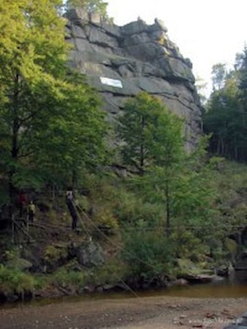
A large group of rocks along the right bank of Kamienna River at the altitude of 718 m above sea level. The group consists of two huge granite towers 30 m high which provide a perfect view point overlooking Kamienna Valley, part of the town and The Izery Mountains. Krucze Skały are the base of extreme sports centre - “Quasar” Mountain School. Instructors are available to assist tourists in practising multi pitch rock climbing, abseiling, descending, slinging, jumping at the, so called, pendulum or walking over a precipice on a rope bridge.
Access: from city centre following the red trail (Sikorskiego Street) and Mickiewicza street.
7 yerel halk öneriyor
Krucze skaly
A large group of rocks along the right bank of Kamienna River at the altitude of 718 m above sea level. The group consists of two huge granite towers 30 m high which provide a perfect view point overlooking Kamienna Valley, part of the town and The Izery Mountains. Krucze Skały are the base of extreme sports centre - “Quasar” Mountain School. Instructors are available to assist tourists in practising multi pitch rock climbing, abseiling, descending, slinging, jumping at the, so called, pendulum or walking over a precipice on a rope bridge.
Access: from city centre following the red trail (Sikorskiego Street) and Mickiewicza street.
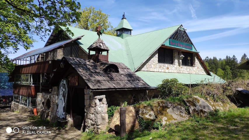
The seat of Walloons, Medieval masters in excavating and processing natural minerals, iron ores, metals, precious stones and quartz.
Old Hut is placed at the bifurcation of the Czech path leading to the springs of Łaba river, the place of ancient cult and black trail surrounding Szklarska Poręba.
A Sculpture Workshop is open next to the Hut.
In dark chambers of the Hut meetings are held during which visitors can listen to tales about Walloons who used to inhibit The Sudety Mountains, as well as old stories and legends about these mountains. Rich collection of semi-precious stones also presents these typical for The Karkonosze Mountains.
JUNA Dünya Müzesi
9 JeleniogórskaThe seat of Walloons, Medieval masters in excavating and processing natural minerals, iron ores, metals, precious stones and quartz.
Old Hut is placed at the bifurcation of the Czech path leading to the springs of Łaba river, the place of ancient cult and black trail surrounding Szklarska Poręba.
A Sculpture Workshop is open next to the Hut.
In dark chambers of the Hut meetings are held during which visitors can listen to tales about Walloons who used to inhibit The Sudety Mountains, as well as old stories and legends about these mountains. Rich collection of semi-precious stones also presents these typical for The Karkonosze Mountains.
Owing to abundant resources of quartz and wood in the forests surrounding The Karkonosze Mountains Szklarska Poręba has been known for many centuries for crystal glass manufacturing. First glass factory was opened in Szklarska Poręba Dolna [Lower Szklarska Poręba] at Szklarski Potok[Szklarski Creek] in the middle of 14th century.
Today the many centuries lasting tradition of glass manufacturing is preserved by Mr Henryk Łubkowski, who turned Leśna Huta into family business. Visitors coming there can watch coloured glass being hand made in front of their eyes. The factory manufactures diversified glass forms and ornaments, like flower vases or table glassware. In manufacturing process old tools and moulds are used, which results in better perfection of products made by expert craftsmen. Broken glass and admixture of glazier’s sand are base materials used in the manufacturing process.
Leśna Huta
2 KołłątajaOwing to abundant resources of quartz and wood in the forests surrounding The Karkonosze Mountains Szklarska Poręba has been known for many centuries for crystal glass manufacturing. First glass factory was opened in Szklarska Poręba Dolna [Lower Szklarska Poręba] at Szklarski Potok[Szklarski Creek] in the middle of 14th century.
Today the many centuries lasting tradition of glass manufacturing is preserved by Mr Henryk Łubkowski, who turned Leśna Huta into family business. Visitors coming there can watch coloured glass being hand made in front of their eyes. The factory manufactures diversified glass forms and ornaments, like flower vases or table glassware. In manufacturing process old tools and moulds are used, which results in better perfection of products made by expert craftsmen. Broken glass and admixture of glazier’s sand are base materials used in the manufacturing process.
All tourists interested in the diversity and natural abundance of The Karkonosze Mountains are welcome in the Karkonoskie Centre of Ecological Education KPN.
In the course of quite an educational visit tourists may learn a lot about the world of animate and inanimate nature at Polish and Czech side of the mountains. Interactive presentations show postglacial kettles, peat bogs, flora and fauna, woods, natural phenomena and many-sided influences on human beings on the mountains. The exposition is even more attractive due to big format panoramas, touch active miniature model of The Karkonosze in four language versions: Polish, Czech, German and English. Film shows, diaporas and all kinds of presentations are held in a comfortable show room. It is all supports by changing temporary exhibitions and access to a modern library with a reading room.
Apart from the exposition offered in the Karkonoskie Centre of Ecological Education its staff also organizes educational classes, both in the Centre and outside it, for organized groups of primary, secondary school and university students, teachers and local community. In the Centre visitors can buy books, maps, folders and other publications which promote The Karkonosze Mountains.
The Centre is adjusted for disabled visitors.
Karkonoskie Centrum Edukacji Ekologicznej
28 OkrzeiAll tourists interested in the diversity and natural abundance of The Karkonosze Mountains are welcome in the Karkonoskie Centre of Ecological Education KPN.
In the course of quite an educational visit tourists may learn a lot about the world of animate and inanimate nature at Polish and Czech side of the mountains. Interactive presentations show postglacial kettles, peat bogs, flora and fauna, woods, natural phenomena and many-sided influences on human beings on the mountains. The exposition is even more attractive due to big format panoramas, touch active miniature model of The Karkonosze in four language versions: Polish, Czech, German and English. Film shows, diaporas and all kinds of presentations are held in a comfortable show room. It is all supports by changing temporary exhibitions and access to a modern library with a reading room.
Apart from the exposition offered in the Karkonoskie Centre of Ecological Education its staff also organizes educational classes, both in the Centre and outside it, for organized groups of primary, secondary school and university students, teachers and local community. In the Centre visitors can buy books, maps, folders and other publications which promote The Karkonosze Mountains.
The Centre is adjusted for disabled visitors.
Since the 19th century Chybotek has been one of major tourist attractions in Szklarska Poręba. Several meters high group of rocks is made up of a few granite blocks. The top rock of 4 m in diameter is supported in its two points and can easily be put into swinging motion. Owing to its shape it has also been called “A bowl of sugar”.
Numerous Walloons tales and legends about the Ghost of the Mountains frequently mention Chybotek as the rock surrounded by the veil of mystery since, according to old-time stories, it used to close the entrance to an underground treasury.
How to get there: from a blue trail, nearby Złoty Widok [Golden View] and Grób Karkonosza [Karkonosz’s Grave].
12 yerel halk öneriyor
Chybotek
Since the 19th century Chybotek has been one of major tourist attractions in Szklarska Poręba. Several meters high group of rocks is made up of a few granite blocks. The top rock of 4 m in diameter is supported in its two points and can easily be put into swinging motion. Owing to its shape it has also been called “A bowl of sugar”.
Numerous Walloons tales and legends about the Ghost of the Mountains frequently mention Chybotek as the rock surrounded by the veil of mystery since, according to old-time stories, it used to close the entrance to an underground treasury.
How to get there: from a blue trail, nearby Złoty Widok [Golden View] and Grób Karkonosza [Karkonosz’s Grave].
Okolice
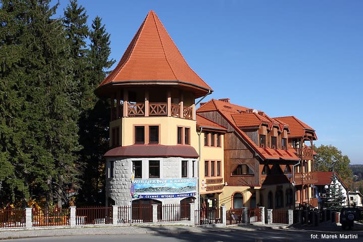
Karpacz is a spa town and ski resort in Jelenia Góra County, Lower Silesian Voivodeship, south-western Poland, and one of the most important centres for mountain hiking and skiing, including ski jumping. Its population is about 4,500. Karpacz is situated in the Karkonosze Mountains – a resort with increasing importance for tourism as an alternative to the Alps.
Karpacz is located at 480 to 885 metres (1,575–2,904 ft) above sea level. South of Karpacz on the border to the Czech Republic there is Mount Sněžka-Śnieżka (1,602 m (5,256 ft)).
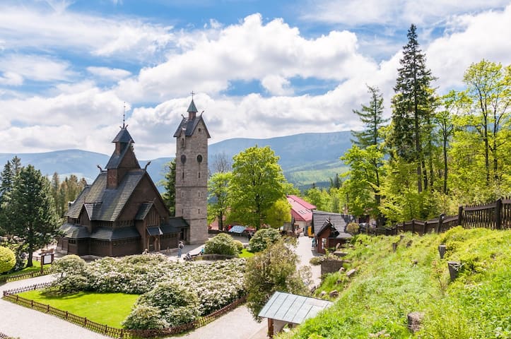
In Karpacz Górny a gravity hill is located where bottles appear to roll uphill. There is also a Norwegian stave church, moved here from Vang, Norway in the mid-19th century. Tourists very often choose to go hiking on local mountain trails.
28 yerel halk öneriyor
Karpacz
Karpacz is a spa town and ski resort in Jelenia Góra County, Lower Silesian Voivodeship, south-western Poland, and one of the most important centres for mountain hiking and skiing, including ski jumping. Its population is about 4,500. Karpacz is situated in the Karkonosze Mountains – a resort with increasing importance for tourism as an alternative to the Alps.
Karpacz is located at 480 to 885 metres (1,575–2,904 ft) above sea level. South of Karpacz on the border to the Czech Republic there is Mount Sněžka-Śnieżka (1,602 m (5,256 ft)).
In Karpacz Górny a gravity hill is located where bottles appear to roll uphill. There is also a Norwegian stave church, moved here from Vang, Norway in the mid-19th century. Tourists very often choose to go hiking on local mountain trails.
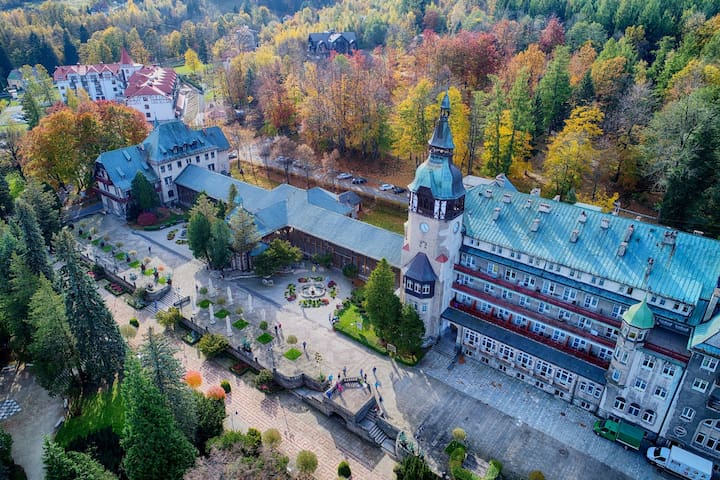
Świeradów-Zdrój is a spa town in Lubań County, Lower Silesian Voivodeship, in south-western Poland near the border with the Czech Republic. The town is located in the Kwisa valley of the Jizera Mountains, a part of the Sudetes range. It lies approximately 25 kilometres (16 mi) south of Lubań, and 123 kilometres (76 mi) west of the regional capital Wrocław.
Świeradów received its town privileges in 1946. As at 2019, it has a population of 4,147.
The spa house built in 1899 offers mineral water, radon and mud bath treatments of rheumatism and other adult diseases.
In 2008, a gondola was opened as the fourth such ski lift in Poland improving the position of Świeradów as a winter ski resort. Newest attraction in Swieradow Zdroj is SKY WALK- Trail in the Clouds. A unique landmark towering will take you to a height of 62 metres above the ground, from where you can see the romantic spa town and the natural beauty of the border area.
9 yerel halk öneriyor
Świeradów-Zdrój
Świeradów-Zdrój is a spa town in Lubań County, Lower Silesian Voivodeship, in south-western Poland near the border with the Czech Republic. The town is located in the Kwisa valley of the Jizera Mountains, a part of the Sudetes range. It lies approximately 25 kilometres (16 mi) south of Lubań, and 123 kilometres (76 mi) west of the regional capital Wrocław.
Świeradów received its town privileges in 1946. As at 2019, it has a population of 4,147.
The spa house built in 1899 offers mineral water, radon and mud bath treatments of rheumatism and other adult diseases.
In 2008, a gondola was opened as the fourth such ski lift in Poland improving the position of Świeradów as a winter ski resort. Newest attraction in Swieradow Zdroj is SKY WALK- Trail in the Clouds. A unique landmark towering will take you to a height of 62 metres above the ground, from where you can see the romantic spa town and the natural beauty of the border area.
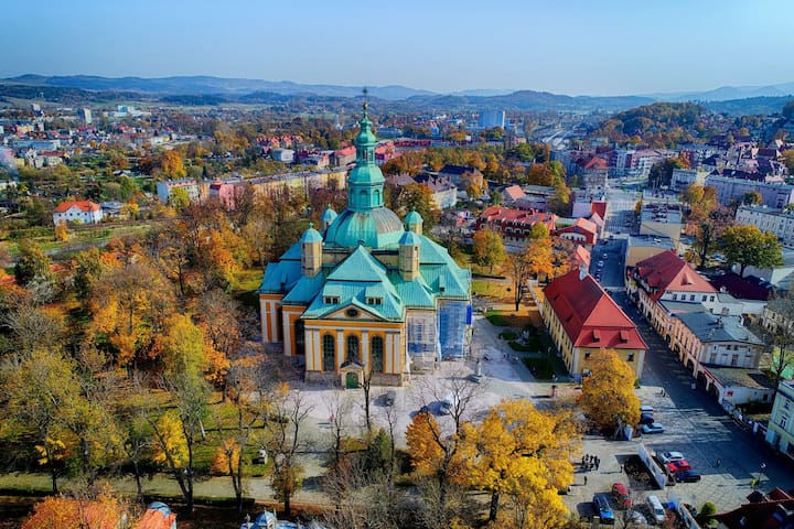
Jelenia Góra is not only the city with 900 years old history and tradition, many monuments and tourist attractions, first of all it’s a perfect starting point for walking around nearest neighborhood and hiking in the mountains. There is a health resort- Cieplice, one of the most popular Polish spas. The treatment is carried out with thermal, fluoride and siliceous waters (temp. up to 86 st.C) and therapeutic muds.
14 yerel halk öneriyor
Jelenia Góra
Jelenia Góra is not only the city with 900 years old history and tradition, many monuments and tourist attractions, first of all it’s a perfect starting point for walking around nearest neighborhood and hiking in the mountains. There is a health resort- Cieplice, one of the most popular Polish spas. The treatment is carried out with thermal, fluoride and siliceous waters (temp. up to 86 st.C) and therapeutic muds.
Jakuszyce
Piechowice